THOUGHT LEADERSHIP
Flood forecasting for a safer dam upgrade

An effective flood forecasting system is a vital tool for managing the significant risks that floods pose to communities, infrastructure and the environment.
If you can clearly understand the likelihood and scale of potential flooding and get accurate and timely warnings, you can better manage water infrastructure and implement safety plans in time to protect assets and communities at risk.
For hydropower businesses such as Hydro Tasmania, flood forecasting is a critical part of managing dam risk. Specialist power and water consulting firm Entura provides real-time inflow and flood forecasting and data management solutions to help manage Hydro Tasmania’s extensive catchments and 55 major dams.
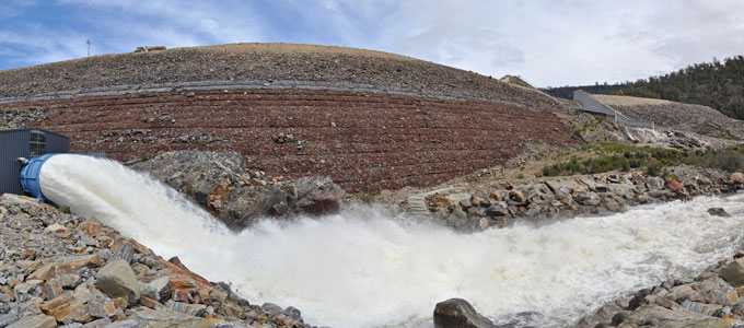
Our most recent example of the risk-reducing benefits of flood forecasting systems is the major upgrade in 2014–15 of the Rowallan Dam on the Mersey River in Tasmania’s north, first built in 1968. The 43m-high earth and rockfill dam needed total refurbishment to be sure of a long, safe future.
Significant work was needed to bring the dam up to modern engineering standards and to increase its capacity to withstand large floods. To complete the necessary upgrade works, Rowallan Dam had to be excavated from crest to foundation on both sides of the spillway walls, exposing the heart of the dam.
The Rowallan Dam flood forecasting system allowed operators to confidently manage the flood risk during construction, ensuring the safety of construction workers and the public downstream, and protecting infrastructure and the environment from major flood damage.
The need for flood and lake-level forecasting at Rowallan Dam
During the construction phase of the major upgrade, Rowallan Dam faced a higher than normal risk of exposure to floods. Overtopping of the temporarily lowered dam crest during construction would compromise dam safety.
Kim Robinson, Senior Hydrologist and Project Manager for the Rowallan Dam flood forecasting system, said “This work was unprecedented in Australia because it was undertaken on a live dam, holding back Lake Rowallan – with a capacity of 130 000 megalitres.”
Kim explained that forecasts of lake levels were needed so that Lake Rowallan could be kept at the appropriate target level during the major excavation and refurbishment works. For safe work, the lake level needed to be lowered significantly by periodically opening a bypass valve to release water from the lake.
“The lake level needed to be low enough for safety, while also not losing too much valuable water, and potential revenue, by releasing too much water through bypass valves rather than through the power station,” Kim said.
As well as the required forecast of lake levels, a flood forecast was needed to indicate when emergency backfilling of the dam crest may be needed.
“The sensitivity of when to trigger this kind of action was a particular challenge” said Kim. “If backfilling was not carried out in time and a flood breached the construction works, the dam would be at risk of failure, with serious consequences for the storage downstream and potential impacts on communities.”
On the other hand, triggering an emergency backfill would be likely to delay construction by a year, with large financial impacts. “Backfilling is expensive and would risk extending the construction period into the wet season and the following summer,” said Kim, “which would be very costly both in terms of construction and from losing water that could have been used to generate power”.
A robust, effective flood forecasting solution
The solution to maintaining optimum lake levels and flood preparations during the Rowallan Dam upgrade was to develop a best-practice flood forecasting system, combining measured data from sensors at key locations with rainfall forecasts from weather forecasting agencies into a hydrologic model of the catchment.
“The modelling predicted lake levels and the time it would take for water to reach critical levels that could jeopardise the dam, always ensuring sufficient time for emergency backfilling,” Kim Robinson said. “The critical level varied depending on the depth of construction works, and maintained the same level of flood risk at all times.”
The entire modelling process ran automatically and provided an updated forecast every two hours during the construction period. Plots were developed showing the best-estimate forecast of inflow and lake level and rainfall over the catchment. The operators and construction managers used these plots to guide the operation of the valves to keep the lake at appropriate levels and to ensure appropriate preparation for emergencies.
Kim Robinson explained that alerts were set to trigger if the forecast exceeded the critical level. Plots were disseminated continually via email and a website. In an emergency, SMS and SCADA flood alerts would be sent out to relevant parties. If a flood alert was issued, the dam safety emergency plan would be activated.
“The system was made more robust by building in redundancies in the modelling and developing a stand-alone system at the dam site that did not require continuous connection to the database. This could be used if communications with the dam site were lost,” said Kim.
Striving for accuracy and certainty
For users to have confidence in the outputs of the flood forecasting system, it was important that the input data and hydrologic modelling were as accurate as possible, and that the level of certainty of the forecasts was clear.
“A plan was put in place to ensure that critical rainfall and flow gauges for the modelling were operational and that any maintenance required was undertaken within strict timeframes,” Kim Robinson said. “We developed routines to automatically check all input data for errors or missing data, and send alerts if inconsistencies were detected.”
Kim explained that the flood forecasting outputs included indications for operators of the uncertainty of both the rainfall forecasts and the modelling. “We developed the rainfall forecast uncertainty measures by comparing forecast rainfall to rain-gauge data over a historical period. The model uncertainty was estimated by running the model over a historical period with historical rainfall as input, and comparing outputs with measured lake levels,” he said.
The model has permanent ongoing value to the business and is being transitioned into the ongoing inflow and flood forecasting system which is used by Hydro Tasmania to manage power generation and dam safety risk. Learnings from this project are also being rolled out across the rest of a forecasting system which produces forecasts for 31 storages across Hydro Tasmania’s portfolio.
To discuss how Entura can partner with you to develop a best-practice flood forecasting system to help you better manage your flood-related risks, contact David Fuller on +61 438 559 763, Phillip Ellerton on +61 439 010 172 or Shekhar Prince on +61 412 402 110.
MORE THOUGHT LEADERSHIP ARTICLES
September 7, 2015


